
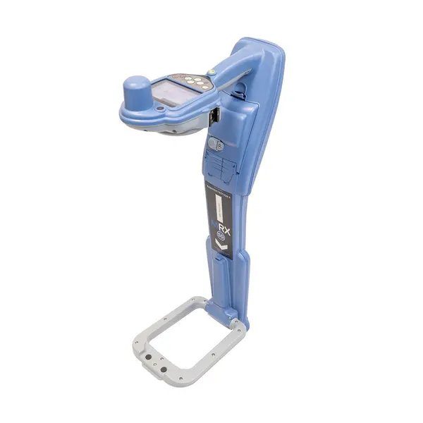
Radiodetection MRX G | Precision Utility Locator | Integrated GPS & Data Logging
The Radiodetection MRX G Locator is a high-performance utility marker locator designed for professional surveyors working in challenging field environments. By combining advanced signal processing with high-accuracy GPS, the MRX G ensures that every locate is verifiable and documented for modern utility contracts.
How does the MRX G ensure field accountability?
The device features integrated GPS that records location data with 2-3 meter (7-10’) accuracy for every locate performed. All survey parameters are stored via automated usage logging, allowing supervisors to access digital audit trails through RD Manager™ Online.
What technology assists with locating parallel utilities?
This locator utilizes Current Direction™ (CD) technology, which provides directional arrows to help operators identify a specific target line among congested parallel services. It offers a frequency range of 21 active locate frequencies and 7 antenna modes for maximum flexibility in complex networks.
Is the MRX G suitable for long-distance utility tracing?
Yes, the MRX G includes 4kHz and low-frequency modes specifically optimized for tracing high-impedance lines such as street lighting and telecoms. For non-metallic infrastructure, the unit supports 4 sonde frequencies and 5 passive modes to ensure detection capability across all asset types.
| GPS Accuracy | 2-3 meters (7-10’) |
| Active Locate Frequencies | 21 |
| Antenna Modes | 7 |
| Passive Modes | 5 |
| Sonde Frequencies | 4 |
| Tracing Modes | 4kHz and low-frequency |
| Reporting Software | RD Manager™ Online |
Enhance the capabilities of your MRX G with these compatible accessories:
- Improve signal application with the Radiodetection TX10B Transmitter.
- Detect ground faults using the Radiodetection A-Frame.
- Protect your equipment in transit with the Radiodetection Locator Tx Transmitter Hard Flight Case.
- Locate non-metallic pipes using the Radiodetection Standard Sonde 33kHz.