
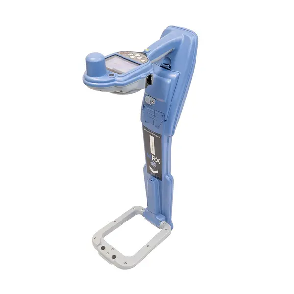
Radiodetection MRX SG Locator | Survey-Grade Utility Mapping | 1-2cm GNSS Precision
What's in the Box
The Radiodetection MRX SG Utility Marker Survey-Grade Locator is a high-performance, triple-functionality device designed for the creation of high-precision digital twins of buried infrastructure. It integrates traditional utility locating, RF marker detection, and centimeter-level GNSS accuracy into a single ergonomic unit, providing 1-2cm (Sub-Inch) mapping precision when connected to RTK correction services. This professional-grade tool is optimized for GIS and surveying professionals who require high-density data capture for critical asset management.
How does the MRX SG achieve survey-grade precision?
The device achieves 1-2cm accuracy by utilizing integrated survey-grade GNSS hardware that connects to RTK correction services. An integrated spirit level ensures the unit remains perpendicular to the ground, guaranteeing the highest accuracy for both depth readings and geo-referenced coordinates.
What infrastructure types can the MRX SG detect simultaneously?
The MRX SG is capable of identifying metallic utilities and detecting passive marker balls in a single pass while recording their exact real-time coordinates. This simultaneous workflow is specifically engineered to reduce the risk of accidental strikes on non-metallic pipes and other critical buried assets.
Which professional mapping features are integrated into the system?
The system features 21 active frequencies, Power Filters, Fault Find, and iLOC remote control for comprehensive utility management. It offers the MAP IT YOUR WAY workflow, providing full compatibility with mapping applications on both iOS and Android mobile devices.
| Precision Levels | 1-2cm (Sub-Inch) Accuracy |
| Detection Modes | Utility, RF Marker, GNSS Mapping |
| Active Frequencies | 21 |
| Connectivity | iOS and Android Mobile Mapping Apps |
| Special Features | Power Filters, iLOC, Fault Find, Current Direction |
| Standard Integration | RTK Correction Support, Spirit Level |
Accessories Section
- Enhance fault finding capabilities by connecting the Radiodetection A-Frame.
- Protect your device during transport with the dedicated Soft Bag for MRX SG.
- Map critical buried points using Radiodetection RF Marker Balls.
- Extend your location capabilities into deep infrastructure with the Radiodetection Super Sonde 33kHz.
- Optimize signal induction with a high-power TX10B Transmitter.