
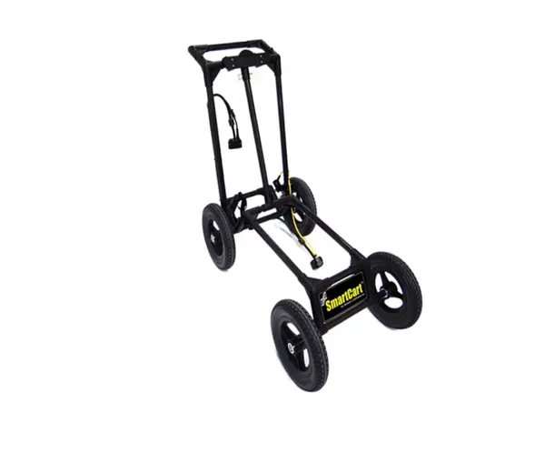
Radiodetection Noggin 500 SmartCart | 500 MHz GPR Mapping | Professional Subsurface Configuration
The Radiodetection Noggin 500 SmartCart Configuration is a professional-grade ground penetrating radar (GPR) solution designed for high-resolution subsurface mapping. By mounting the specialized 500 MHz NOGGIN sensor onto a robust, four-wheeled SmartCart, this configuration provides a stable platform for accurate data collection in demanding field environments. It is a critical tool for utility detection, site assessments, and geological investigations.
What are the primary applications for the Noggin 500 SmartCart?
This system is specifically optimized for subsurface investigations and high-resolution mapping on both smooth and moderately rough terrains. It enables professionals to generate reliable data for complex utility detection and detailed site assessment projects.
How does the 500 MHz sensor improve mapping efficiency?
The 500 MHz NOGGIN sensor provides a superior balance between signal depth and resolution, perfect for shallow-to-medium depth mapping. The four-wheeled SmartCart design ensures a stable, consistent sensor height and allows for rapid, continuous data acquisition.
Is the SmartCart configuration suitable for rough terrain?
Yes, the rugged cart assembly is engineered for ease of use on various surfaces, including paved areas and moderately rough terrain. This configuration is a must-have for professionals who require a mobile, high-performance GPR setup for varied field conditions.
| Manufacturer | Radiodetection |
| Sensor Frequency | 500 MHz |
| Configuration Type | SmartCart (4-Wheeled) |
| Terrain Capability | Smooth to Moderately Rough |
| Primary Function | Subsurface Mapping & Utility Detection |
- Noggin 500 Unit: The high-resolution sensor core for this configuration.
- Noggin Display (DVL-500): The digital visualization interface for real-time radar data.
- AG-200 GPS Kit: High-precision GNSS integration for georeferencing survey data.
- EKKO_Project V6 Core Software Bundle: Advanced analysis and post-processing software for GPR results.
- SmartCart ATA Shipping Case: Protective transport solution for the integrated cart and display system.