
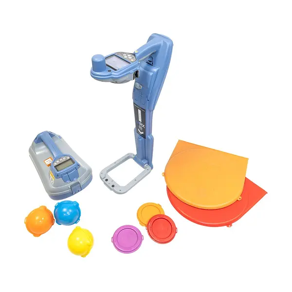
Radiodetection MRX SG Locator Kit | Survey-Grade Utility Mapping | 1-2cm GNSS Accuracy
The Radiodetection MRX SG Locator Kit is an all-in-one professional mapping solution engineered to provide turnkey, survey-grade accuracy for underground infrastructure projects. This UK-manufactured kit features the MRX SG Survey-Grade Locator, an ergonomic powerhouse that combines high-resolution cable and pipe locating with simultaneous electronic RF marker detection and 1-2cm accurate GPS mapping. It serves as the essential package for utility companies and contractors building high-fidelity GIS records through the MAP IT YOUR WAY™ system.
What level of mapping accuracy does the MRX SG provide?
The integrated GNSS RTK technology provides centimeter-precision mapping, allowing for 1-2cm accuracy when recording the location of buried assets. This system enables sub-inch precise digital records for all utility types, including non-conductive lines marked with RF balls.
How does the MRX SG simplify field operations?
It functions as a unified hardware solution, replacing the need for separate locators and GPS handhelds by recording geo-referenced data directly. The system features iLOC® remote transmitter control and seamless integration with mapping software on both Android™ and iOS® devices.
What are the primary signal detection capabilities?
The locator features 21 active frequencies and proprietary Power Filters™ to isolate utility signals from environmental noise. This allows for precise depth measurements up to 2.4m for full-range markers and ensures reliable detection in congested utility corridors.
| Precision Mapping | Integrated GNSS RTK (1-2cm accuracy) |
| Detection Modes | Active Cable/Pipe + RF Marker Detection |
| Frequencies | 21 Active Frequencies |
| Depth Capability | Up to 2.4m (Marker detection) |
| System Compatibility | Android™ and iOS® (MAP IT YOUR WAY™) |
| Remote Function | iLOC® Remote Transmitter Control |
| Data Management | Usage logging and audit-ready records |
| Manufacturing | Designed and Manufactured in the UK |
Kit Accessories & Compatible Components
- Carry Solution: Includes the Radiodetection Soft Bag for RD8200SG / MRX SG for secure transport of all components.
- Device Support: Features a specialized Holder for Phone and External GNSS Kit to facilitate real-time data visualization.
- Transmitter Integration: Fully compatible with the Radiodetection TX10B Transmitter for enhanced signal distance and precision.
- Subsurface Marking: Engineered for use with Radiodetection RF Marker Balls Yellow - Gas and other standard utility markers.