
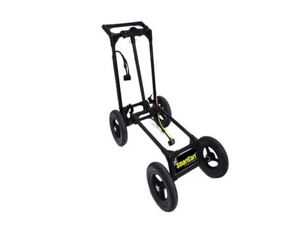
Radiodetection Noggin 1000 SmartCart | High-Resolution Subsurface Radar Mapping
The Noggin 1000 SmartCart Configuration is a professional-grade Ground Penetrating Radar (GPR) solution that integrates a high-resolution 1000 MHz NOGGIN sensor with a rugged SmartCart transport system. Designed for high-density data acquisition, this system is optimized for detailed subsurface mapping and provides the reliability needed in diverse field environments, from smooth surfaces to rough terrains.
What are the primary applications of the Noggin 1000 SmartCart?
This configuration is ideal for high-resolution subsurface mapping projects where capturing small targets and fine structural detail is critical. The 1000 MHz sensor frequency provides the necessary resolution for shallow subsurface investigations in varied professional environments.
How does the SmartCart configuration improve field survey efficiency?
The integrated SmartCart system enables consistent data collection by maintaining stable sensor height and orientation during movement. This results in accurate subsurface mapping and efficient field operations, even when conducting surveys over different terrain types.
Is the Noggin 1000 sensor suitable for challenging terrains?
Yes, the Noggin 1000 SmartCart is specifically engineered for reliable data acquisition in a variety of field environments. Its design ensures that the high-resolution sensor remains productive whether the survey site is relatively smooth or exhibits rough terrain characteristics.
| Manufacturer | Radiodetection |
| Sensor Frequency | 1000 MHz |
| Transport System | SmartCart System |
| Configuration Type | Subsurface Mapping |
| Terrain Compatibility | Smooth to Rough Terrain |
| Primary Benefit | High-Resolution Data Acquisition |
- Integrate your sensor with the Noggin 1000 Unit for standalone radar capabilities.
- Monitor data in real-time using the Noggin Display (DVL-500) for immediate onsite analysis.
- Ensure reliable connectivity with the DVL to Noggin SmartCart Cable with Latches.
- Add precision location data with the AG-200 GPS Kit.
- Protect your investment during transit with the SmartCart ATA Shipping Case.
- Maintain your equipment in peak condition using the Noggin Spare Parts Kit.