
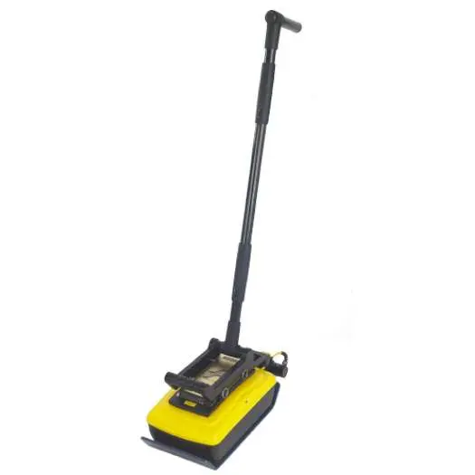
Radiodetection Noggin 500 SmartHandle System | Compact GPR | High-Resolution Subsurface Mapping
The Radiodetection Noggin 500 SmartHandle System is a specialized ground penetrating radar (GPR) solution engineered for high-resolution subsurface mapping in areas where traditional cart systems cannot reach. Featuring a 500 MHz NOGGIN sensor, this compact and lightweight system allows for precise data acquisition on vertical, overhead, or smooth horizontal surfaces. The integrated SmartHandle provides a ergonomic interface for both push and pull operations, making it indispensable for utility mapping in confined spaces and challenging site geometries.
What are the primary applications for the Noggin 500 SmartHandle?
This system is specifically optimized for mapping in confined spaces, vertical surfaces, and overhead environments where standard GPR carts are too large. It is ideal for detailed subsurface utility engineering (SUE) and concrete inspection in tight corridors or industrial utility vaults.
How does the 500 MHz sensor improve mapping accuracy?
The 500 MHz NOGGIN sensor provides a balance of penetration depth and high-resolution imaging, allowing for the detection of smaller subsurface targets with superior clarity. The system captures accurate data while being pushed or pulled over smooth surfaces, ensuring consistent results in complex survey areas.
What makes the SmartHandle design advantageous for field work?
The SmartHandle features a lightweight and compact design that facilitates ease of transport and maneuverability in restricted access sites. It allows the operator to maintain accurate mapping control even in vertical or horizontal orientations, extending the reach of standard GPR applications.
| Attribute | Specification |
| Sensor Frequency | 500 MHz |
| Manufacturer | Radiodetection |
| Operating Mode | Push or Pull |
| Survey Application | Confined, Vertical, and Horizontal |
| System Weight | Compact and Lightweight |
| Data Acquisition | Accurate Subsurface Mapping |
- Utilize the Noggin Display (DVL-500) for real-time data visualization and system control.
- Extend your reach with the Noggin SmartHandle Cable (5m) or the 10m version for larger survey grids.
- Improve operator ergonomics during long surveys with the DVL-500 Carry Harness.
- Connect shorter distance requirements with the Noggin SmartHandle Cable (2.5m).