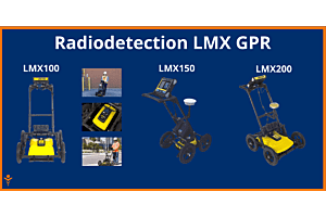
Welcome to the comprehensive guide on the LMX series of ground-penetrating radar systems. This guide aims to provide you with an in-depth look at the key features of each model—LMX100™, LMX150™ FINDAR, and LMX200™—and how they progress in terms of functionalities. Whether you're a beginner or a seasoned professional, this guide will help you understand which model best suits your needs.
Key Features:
- Real-time Locate & Mark™: Acquire data along a line and view it as a cross-section image.
- Back-up Indicator: Pinpoint the target location by pulling the system backward after acquiring some data.
- Position & Depth Indicator: A crosshair on the back-up indicator shows the current position and depth.
- Pause Button: Temporarily stop data collection in No Save Mode and resume without clearing the screen.
- File Management: Data is logically organized for easy review and transfer.
Progression:
The LMX100™ serves as the entry-level model, offering basic yet essential features for ground-penetrating radar systems. It is ideal for users who require straightforward functionalities without the complexities of advanced settings.
Key Features:
- Line Data Playback: Save and view any collected line data.
- GPS Status Indicator: Indicates the signal quality of the selected GPS, whether internal or external.
- SplitView: Display LineView and MapView simultaneously for a quick positional relationship between targets.
- On-site Grid Scan: Collect grid data and generate depth slices in the field.
- Guided Grid Setup: Allows you to select grid size and resolution.
Progression:
Building on the LMX100™, the LMX150™ FINDAR introduces additional features like Line Data Playback and GPS Status Indicator. It also offers more advanced grid scanning capabilities, making it suitable for more complex tasks and professional use.
Key Features:
- Zoom – Position & Depth: Vary the length and depth of data displayed on the screen.
- Filter & Gain: Filter out flat-lying responses and adjust the amplification of GPR data.
- Interpretations: Mark subsurface features as a colored dot by touching the screen.
- Data Export: One-click data export to a USB drive and automatic export of positional information for interpretations and flags as a .CSV file.
- EKKO_Project™ GPR Software Bundles: Software bundles for added data processing, analysis, and visualization.
Progression:
The LMX200™ is the most advanced model in the series, incorporating all the features of the previous models and adding several more. It offers the most comprehensive set of tools for data collection, analysis, and export, making it the go-to choice for professionals who require the highest level of functionality and versatility.
Radiodetection LMX GPR Comparison Tables
So you can compare yopurself with each aspect, feel free to browse the following comparison tables
Line Scan Mode Features
| Features | Description | LMX100™ | LMX150™ FINDAR | LMX200™ |
|---|
| Real-time Locate & Mark™ | Acquire data along a line and view it as a cross-section image | ✓ | ✓ | ✓ |
| Line Data playback | Save and view any collected line data | ✕ | ✓ | ✓ |
| Back-up indicator | After acquiring some data on the screen, pull the system backwards to pinpoint target location | ✓ | ✓ | ✓ |
| Position & Depth Indicator | Crosshair on back-up indicator shows current position and depth | ✓ | ✓ | ✓ |
| Pop-up info box | Touch and hold the screen to generate a movable depth and position info box | ✓ | ✓ | ✓ |
| Pause Button | In No Save Mode, temporarily stop data collection and resume again without clearing the data from the screen | ✓ | ✓ | ✓ |
| Drawing arrows | In No Save Mode, draw arrows on the screen to highlight features | ✓ | ✓ | ✓ |
| GPS Status indicator | Indicates the signal quality of the selected GPS (internal or external) | ✕ | ✓ | ✓ |
| SplitView | Display LineView and MapView simultaneously to quickly see the positional relationship between targets (external GPS only) | ✕ | ✓ | ✓ |
Real-time Viewing Options in Line Scan
| Features | Description | LMX100™ | LMX150™ FINDAR | LMX200™ |
|---|
| Zoom – Position | Vary the length of data displayed on the screen | ✓ | ✓ | ✓ |
| Zoom – Depth | Vary the depth of data displayed on the screen | ✓ | ✓ | ✓ |
| Color | View data with different color palettes | ✓ | ✓ | ✓ |
| Filter | Filter out flat-lying responses in the data using 5 preset filter levels | ✓ | ✓ | ✓ |
| Gain | Adjust amplification of GPR data to make weaker or deeper targets visible | ✓ | ✓ | ✓ |
| Soil Cal | Calibrate velocity for accurate depth measurements; hyperbola-fitting method or select from available pre-set Soil Cal values | ✓ | ✓ | ✓ |
| Interpretations | Mark subsurface features as a colored dot by touching anywhere on the screen | ✕ | ✓ | ✓ |
| Flags | Mark noteworthy above-ground features with sequentially numbered flags | ✓ | ✓ | ✓ |
Grid Scan Mode Features
| Features | Description | LMX100™ | LMX150™ FINDAR | LMX200™ |
|---|
| On-site grid scan | Collect grid data and generate depth slices in the field | ✕ | ✓ | ✓ |
| Guided grid setup | Select grid size and resolution | ✕ | ✓ | ✓ |
| Guided data collection on the Display unit | Guides user through data collection with intuitive visual and audio prompts | ✕ | ✓ | ✓ |
| Recollect grid lines | Recollect any grid line if you make a mistake | ✕ | ✓ | ✓ |
| Collect partial grid lines | Stop any grid line early to avoid an obstacle | ✕ | ✓ | ✓ |
| Skip grid lines | Skip a grid line with a touch of a button if the line does not need to be collected | ✕ | ✓ | ✓ |
| Obstacle Avoidance | The system guides you through collecting a grid around an obstacle | ✕ | ✓ | ✓ |
| Depth slices from incomplete grids | Generate depth slices with an incomplete grid | ✕ | ✓ | ✓ |
| Grid line playback | View previously collected grid lines | ✕ | ✓ | ✓ |
Additional Features
| Features | Description | LMX100™ | LMX150™ FINDAR | LMX200™ |
|---|
| MapView | Graphically view the path traveled by the system, any flags or interpretations added as well as the ability to cycle through processed depth slices (External GPS only) | ✕ | ✓ | ✓ |
| MapView (Internal GPS) | Graphically show collected grid locations and processed depth slices | ✕ | ✓ | ✓ |
| External GPS port | Option to connect an external GPS for increased positional accuracy | ✕ | ✓ | ✓ |
| Screenshots | Saves the current screen image to a JPG file | ✓ | ✓ | ✓ |
| DynaQ | Dynamic Quality Enhancement – Automatically adjusts data quality based on system speed | ✓ | ✓ | ✓ |
| DynaT | Dynamic Target Enhancement – allows the user to selectively view small, medium or large subsurface targets for easier viewing and detection | ✓ | ✓ | ✓ |
| File Management | Data is logically organized for review and transfer | ✓ | ✓ | ✓ |
Data Export Features
| Features | Description | LMX100™ | LMX150™ FINDAR | LMX200™ |
|---|
| USB data transfer | One-click data export to a USB drive | ✓ | ✓ | ✓ |
| Field Interpretations file (.CSV) | Positional information for interpretations and flags automatically exported as a .CSV file | ✕ | ✓ | ✓ |
| Geotagged Screenshots (.JPG) | Exports screenshots as JPG files | ✓ | ✓ | ✓ |
| KMZ Files | Screenshots, survey paths and field interpretations are automatically exported to .KMZ files for viewing in Google Earth™ | ✓ | ✓ | ✓ |
| Project files (.GPZ) | All data (lines, grids & screenshots) in a project are saved as a .GPZ file | ✕ | ✓ | ✓ |
| Wi-Fi Mini Reports | From the field, email reports containing screenshots and information about the collected data | ✓ | ✓ | ✓ |
| System usage report | A PDF report containing usage statistics and system diagnostics | ✓ | ✓ | ✓ |
GPR Analysis and Reporting Software Features
| Features | Description | LMX100™ | LMX150™ FINDAR | LMX200™ |
|---|
| GPR Data Export to optional EKKO_Project™ Core | Open project files to organize data files, view data and generate reports | ✕ | ✓ | ✓ |
| EKKO_Project™ GPR Software Bundles | Software bundles for added data processing, analysis and visualization | ✕ | ✓ | ✓ |
GPR System Specifications
| Features | Description | LMX100™ | LMX150™ FINDAR | LMX200™ |
|---|
| Center Frequency (MHz) | Center frequency of GPR system | 250 | 500 | 250 |
| Weight | Lightweight GPR system | 22 kg (48 lb) | 19 kg (41 lb) | 22 kg (48 lb) |
| System Size | Compact GPR Cart | 100 x 70 x 115 cm (39.4 x 27.6 x 45.3 in) | 115 × 55 × 90 cm (45 × 21 × 35 in) | 100 x 70 x 115 cm (39.4 x 27.6 x 45.3 in) |
| Max Depth | Maximum depth of data collected and displayed on the display unit | 8 m (26 ft) | 3 m (10 ft) | 8 m (26 ft) |


Login and Registration Form